Ask Ethan: How do we know the Earth isn’t flat?

Today, it’s the most obvious thing in the world. But how do you prove it to yourself?
“A long time ago people believed that the world is flat and the moon is made of green cheese. Some still do, to this day. The man on the moon is looking down and laughing.” –Vera Nazarian
Every once in a while, a hoax or claim that’s so spectacularly absurd goes viral that even the most circumspect bystanders can be taken in. Yet science doesn’t stop being true just because some people refuse to accept it. The beautiful thing about any scientific question is this: if you yourself become enough of an expert, you can figure out the answer for yourself. This ability to convince yourself of the truth, despite what any authority figure might say, is what separates science from all other endeavors. And with a round-Earth denying friend, that’s exactly what Michael Gratton wants from this week’s Ask Ethan:
“[I] have this friend who thinks and preaches the “flat earth” theory for a few years now, I don’t believe the planet or any is flat for that matter but what are your views on this topic/theory?”
The wonderful thing is it’s not a belief for me; it’s a conclusion.
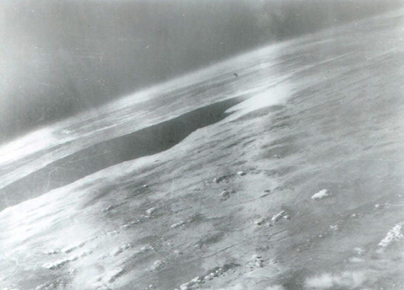
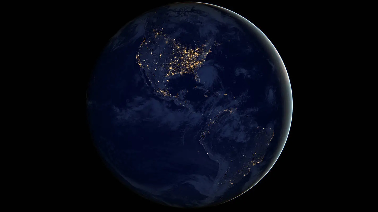
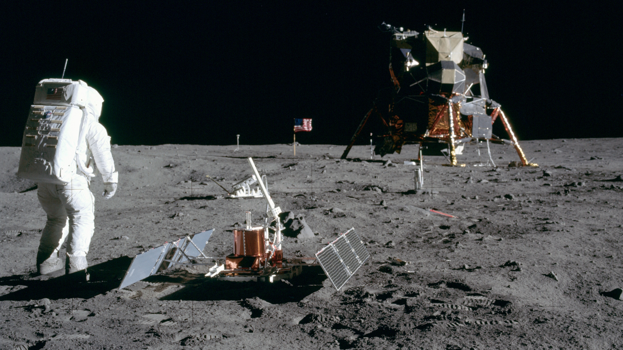
Sure, we can do the simplest thing of all: go to space itself and photograph the Earth. Beginning in the 1940s, our rockets were capable of achieving high enough altitudes to photograph the curvature of the Earth directly. As we progressed further and further out, from sub-orbital heights to low-Earth orbit to great distances from Earth, we obtained better and better views of our planet, eventually seeing the entire thing at once. We’ve even visited other worlds in the Solar System, using the gravitational influence of Earth and other worlds for gravity assists to help us get there. NASA’s Messenger probe took advantage of this a few years ago, snapping a series of photos as it flew by Earth, catching our very round planet rotating as it passed us by.
Prior to the 1940s, however, it wasn’t possible to tell the shape of Earth by leaving it and looking at it. Without the assistance of modern technology, it might seem impossible to answer this question, the same way you’d never be able to see your own eye color without a reflection, a photograph or other external sources of information. But we actually have a few pieces of evidence that tell us the shape of our planet that don’t require us to leave Earth and take a picture. Consider, for example, what happens when we have a lunar eclipse: when the Earth passes between the Sun and the Moon.
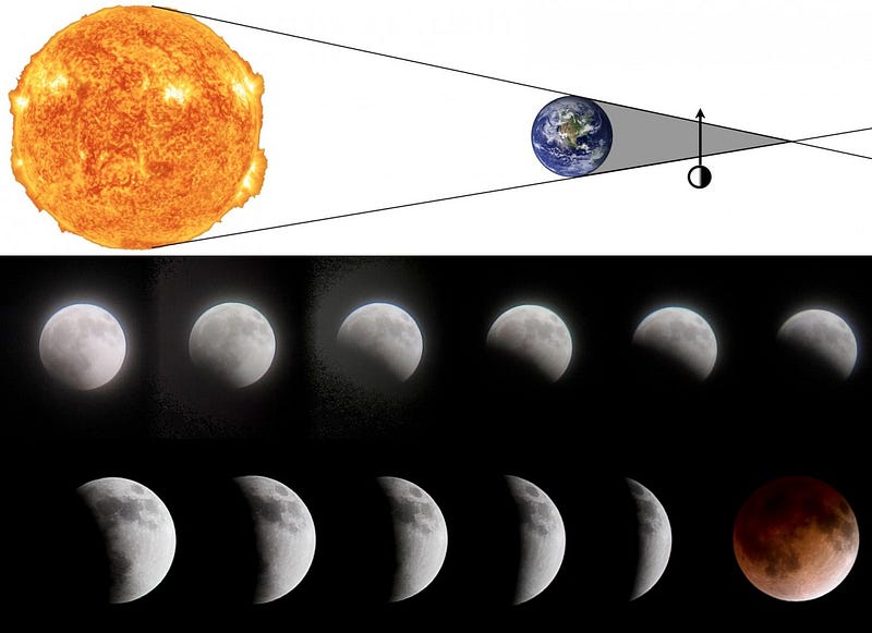
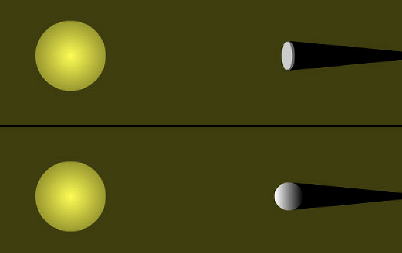
What we see, when we look at the Moon during this perfect or near-perfect alignment, is the shadow of the Earth on the Moon. And no matter when this eclipse happens — what time of the year it is, where the Earth is in orbit around the Sun, or which locations on Earth can see it — the shadow always tells the same story: the Earth’s shadow is circular in shape, with a physical size significantly larger than that of the Moon. You might contend that the Earth might be a flat disc or circle rather than a spherical (or spheroidal) shape, but the fact that we see the Moon and stars rise at different time at different locations (i.e., longitudes) and that it’s possible to circumnavigate the globe make the flat disc option impossible.
But perhaps you don’t even want 1500s level technology to rely on. Perhaps you don’t want to know about heliocentrism, about the existence of the Moon or even a knowledge of basic geography beyond the tiny region where you live. Believe it or not, this was the situation that Eratosthenes of Cyrene found himself in, some 2300 years ago, when he became the first person to not only conclude that the Earth was round, but to measure its physical size! While living in Alexandria, Eratosthenes received some amazing correspondence from the city of Syene in southern Egypt. In particular, it said that, on the Summer Solstice,
the shadow of someone looking down a deep well would block the reflection of the Sun at noon.
In other words, the Sun would be directly overhead at this time, not a single degree to the South, North, East or West. And if you had a completely vertical object, it would cast absolutely no shadow. As you can see, below there are indeed places in there world where this is the case.
But Eratosthenes knew that this wasn’t the case where he was, in Alexandria. Sure, the Sun came closer to being directly overhead at Noon on the Summer Solstice in Alexandria than at any other time during the year, but vertical objects still cast shadows. And — like any good scientist — Eratosthenes did the experiment. By measuring the length of the shadow cast by a vertical stick during the solstice noon (when the shadow was shortest), he could figure out what angle the Sun made with the vertical direction at Alexandria.
And the answer he got was one-fiftieth of a circle, or 7.2 degrees. But at this time, in Syene, the angle the Sun was making with an identical vertical stick was zero degrees! What could be causing this? In perhaps a stroke of genius, Eratosthenes realized that the Sun’s rays could all be parallel, and that the Earth could be curved!
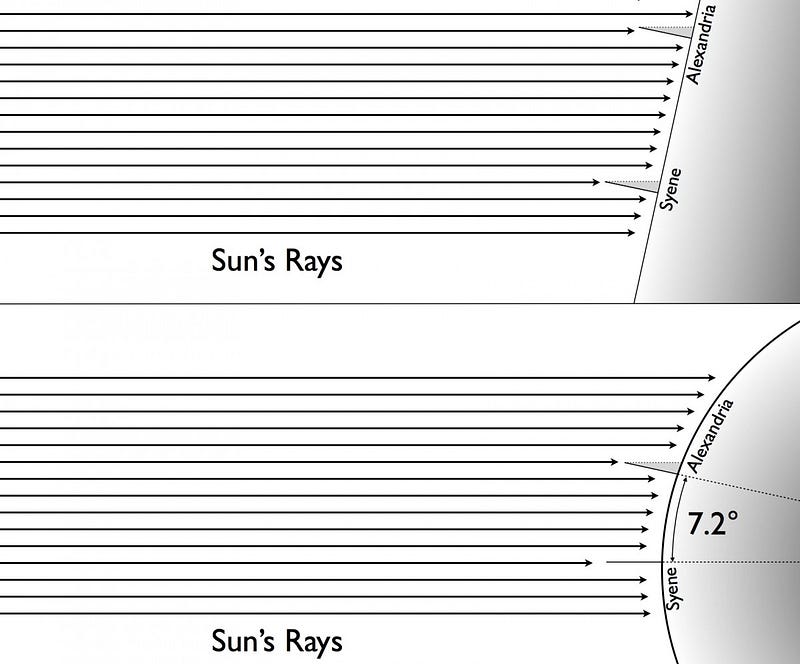
If he could then figure out the distance from Alexandria to Syene, since he knew the angular difference between the two cities, he could figure out the circumference of the Earth! If only Eratosthenes had a grad student, he could have sent one to make the trip, and measure the distance! Instead, he was forced to rely on the reported distance between the two cities. The most “precise” measurement of his day?

Travel-by-camel. (So I can understand criticisms of his accuracy.) Nevertheless, his results were that the distance between Syene and Alexandria were 5,000 stadia. The question, of course, is how big is a stadium? The answer depends, of course, on whether Eratosthenes, a Greek living in Egypt, was using an Attic stadium or an Egyptian stadium, something still debated among historians. An Attic stadium was used more commonly, and is 185 meters in modern terms. Using this value, one gets a circumference of the Earth of 46,620 kilometers, a number that’s only about 16% bigger than the actual value. However, an Egyptian stadium is 157.5 meters, and it’s conceivable that’s what Eratosthenes meant. In that case, we get a value of 39,375 kilometers, which is off by less than 2% from the modern value of 40,041 km!
Regardless of what the actual values were, Eratosthenes went on to become the world’s first geographer, inventing the concepts of latitude and longitude that we still use today, and constructed the first models and maps based on a spherical Earth. Although many things were “lost” during the subsequent millennium-and-a-half, neither the idea of a spherical Earth nor the rough knowledge of the Earth’s circumference were one of them. In fact, anyone can perform this same experiment today with two locations at the same longitude — just travel either North or South from your current location — and with simultaneous measurements of shadow lengths, you too can measure the circumference of the Earth. So, Michael, don’t just take my word for it, go ahead, invite your friend, and do the experiment for yourself. If you’re open to listening to what the Universe tells you about itself, and you put in the time to make a careful measurement and do the geometry correctly, you just might convince yourself of the answer!
Send in your Ask Ethan questions to startswithabang at gmail dot com.
This post first appeared at Forbes, and is brought to you ad-free by our Patreon supporters. Comment on our forum, & buy our first book: Beyond The Galaxy!