Viewing the Earth from space celebrates 70 years
https://players.brightcove.net/2097119709001/4kXWOFbfYx_default/index.html?videoId=5093427476001
In 1946, we made history by photographing the Earth from space for the first time. How far we’ve come!
“You develop an instant global consciousness, a people orientation, an intense dissatisfaction with the state of the world, and a compulsion to do something about it. From out there on the moon, international politics look so petty. You want to grab a politician by the scruff of the neck and drag him a quarter of a million miles out and say, ‘Look at that, you son of a bitch.’”
–Edgar Mitchell
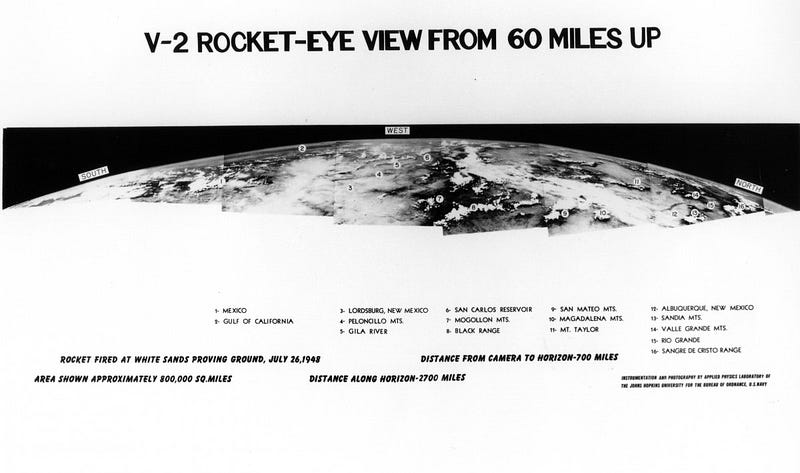
In 1946, the advent of rocket technology from World War II enabled humanity to surpass balloon-borne heights and cross into space for the first time.
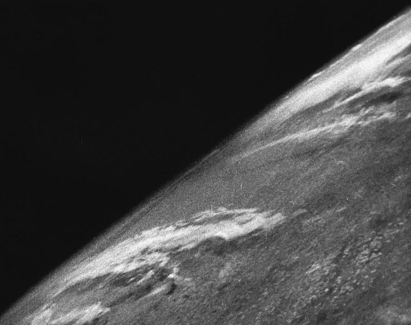
These images, taken from atop V-2 rockets, revealed the blackness of space, as well as the Earth’s true curvature.
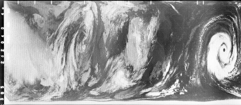
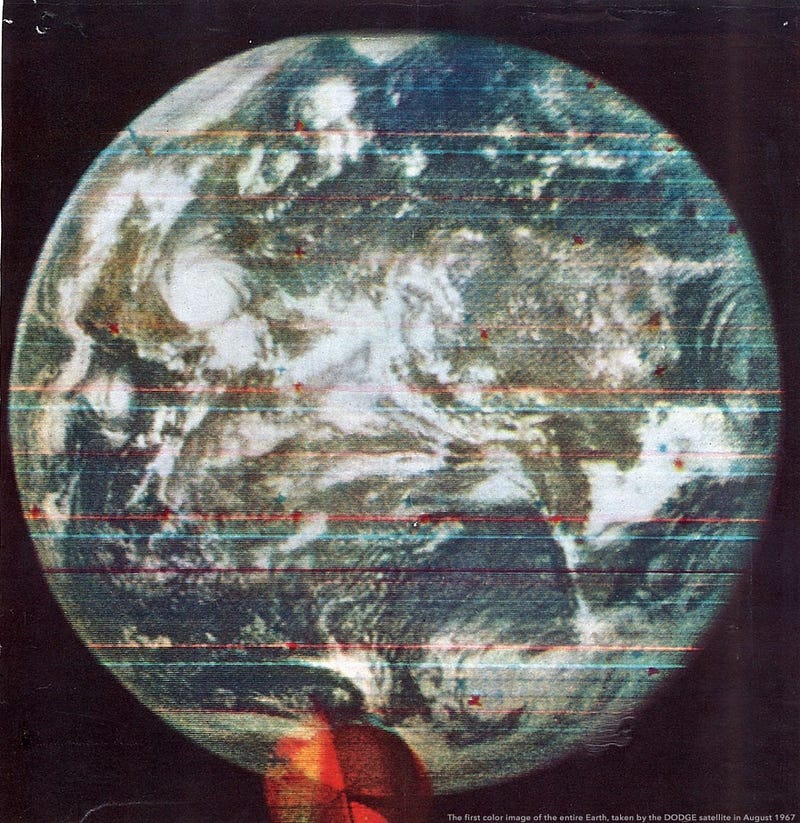
By the 1960s, Earth-monitoring satellites were placed to track weather and other transient phenomena.
By traveling to greater distances, an entire hemisphere of Earth could be photographed at once.
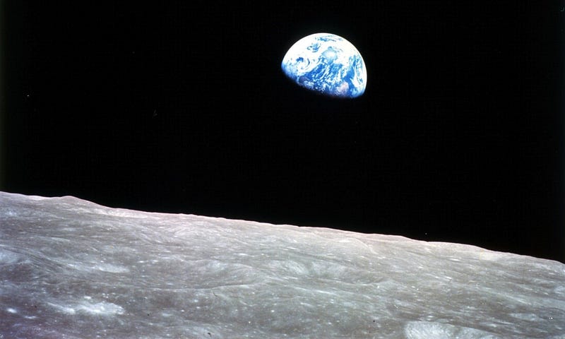
Traveling to the Moon enabled the first color photo of Earth seen rising over the limb of our natural satellite…
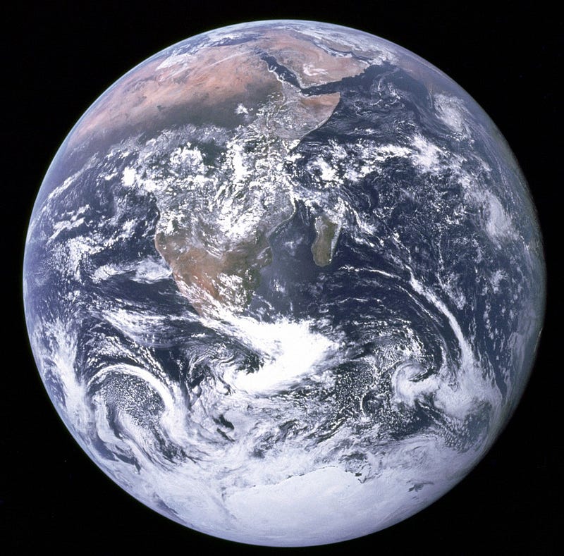
… while departing under just the right lighting conditions enabled the first color photo of the fully illuminated Earth to be taken.
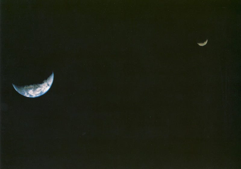
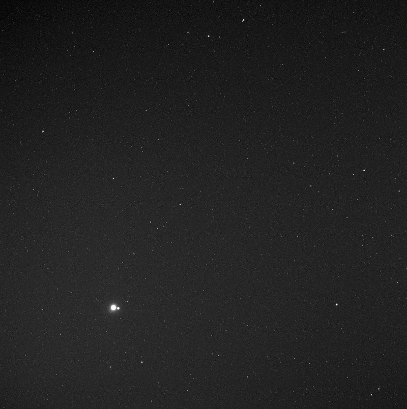
Since then, other spacecraft have imaged the Earth and Moon together, such as Voyager 1 in 1977.
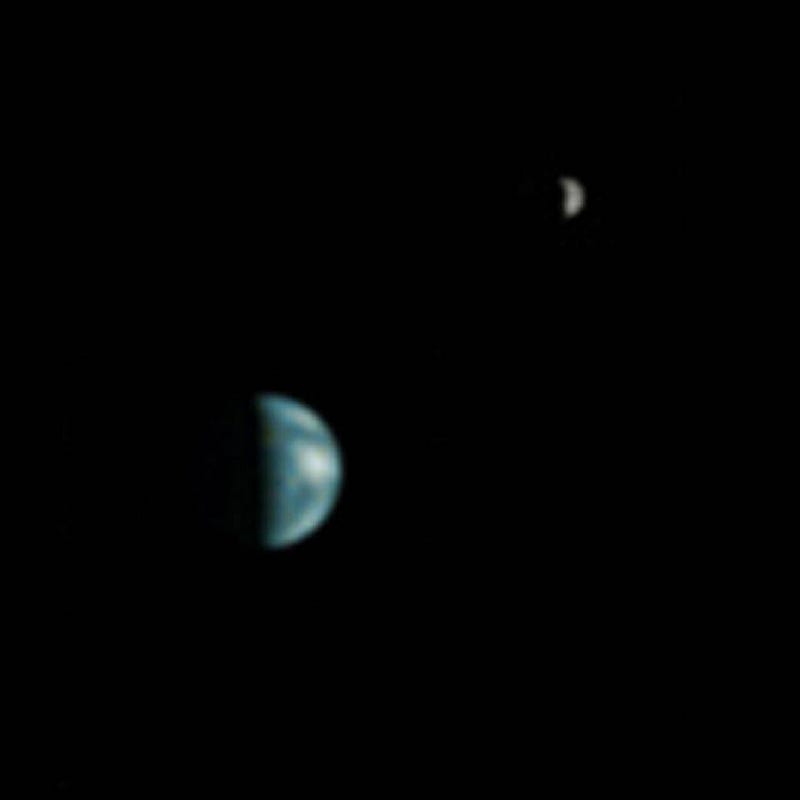
Earth and the Moon have also been seen from Mars, thanks to Mars Global Surveyor in 2003.
And from Mercury, thanks to the Messenger spacecraft in 2010.
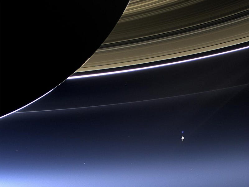
Earth has also been spectacularly viewed from Saturn, thanks to Cassini.
Numerous satellites in low-Earth and geosynchronous orbits view Earth continuously today, enabling the creation of the highest-resolution, full-coverage photos ever.

Mostly Mute Monday tells the story of a single astronomical phenomenon or object primarily in visuals, with no more than 200 words of text.
This post first appeared at Forbes, and is brought to you ad-free by our Patreon supporters. Comment on our forum, & buy our first book: Beyond The Galaxy!