What’s Happening At Kīlauea In Hawaii? 16 Questions With A Front-Line USGS Scientist

Geologically, it might be the most intense Hawaiʻian eruption in over 200 years. But not a single person has died, thanks to science.
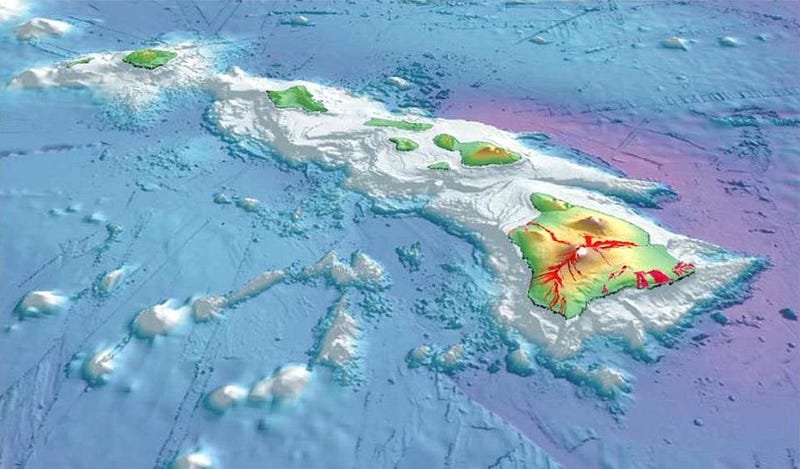
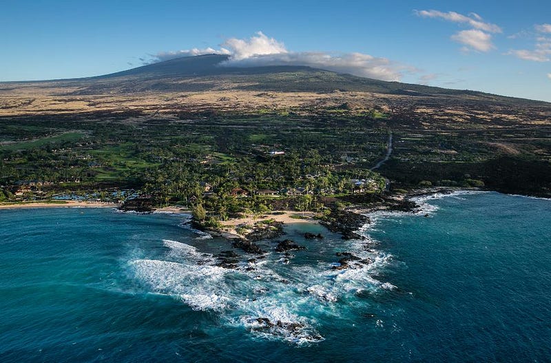
Hawaii, a chain of islands in the Pacific Ocean, was formed by volcanic activity over the past few million years. Lava vents open up in the Earth, and from deep inside our planet’s interior, magma rises up and forms new land masses. Eventually, enough material builds up to climb the three miles from the ocean floor up through the Earth’s surface, creating the tallest base-to-peak mountains on our world.
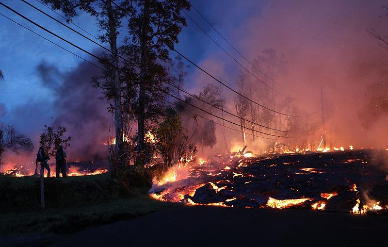
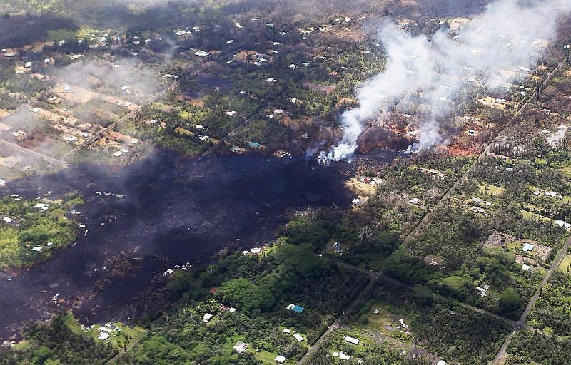
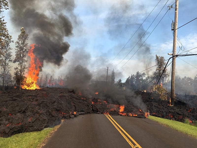
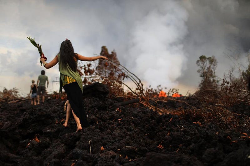
The youngest volcano on the Big Island of Hawaii, Kīlauea, has been continuously erupting since 1983, although the lava has been mostly slow and steady. All of that changed in early May of 2018, however, when seismic activity increased, new lava vents opened up, and the eruption became unpredictable and, in many ways, disastrous. Homes and infrastructure have been destroyed, new fissures have been created, the air has become dangerous to breathe, volcanic ash has fallen, and thousands have been evacuated.
Unlike previous unpredictable eruptions, very few people have been injured and no one has been killed. This is despite long-term population growth in extremely high-risk areas in the rift zones beneath the summit of Kīlauea. The number one reason for that is the work of scientists on the front lines in monitoring the situation, gathering information, and sharing their recommendations openly and freely with the general public. It’s one of the greatest examples of science in action: where what the top experts know is used to inform and assist the people a natural disaster would otherwise affect.
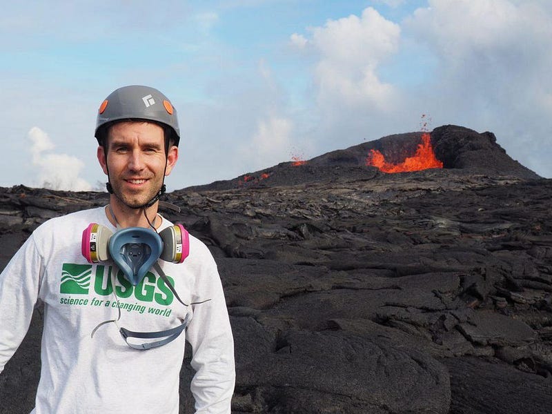
Recently, I had the opportunity to speak with with Brian Shiro, a United States Geological Survey scientist (whose expertise is in seismology) who lives and works on the Big Island in Hawaii. He has been working tirelessly since before the eruption began, and has a unique, firsthand perspective on what’s happening with the eruption right now. The biggest takeaway I took from speaking with him is that this eruption, despite the property damage it’s caused and will continue to cause, doesn’t have to be lethal to anyone so long as we’re prepared, and we’re extremely well-prepared. Here is a transcript* of my exclusive interview with him.
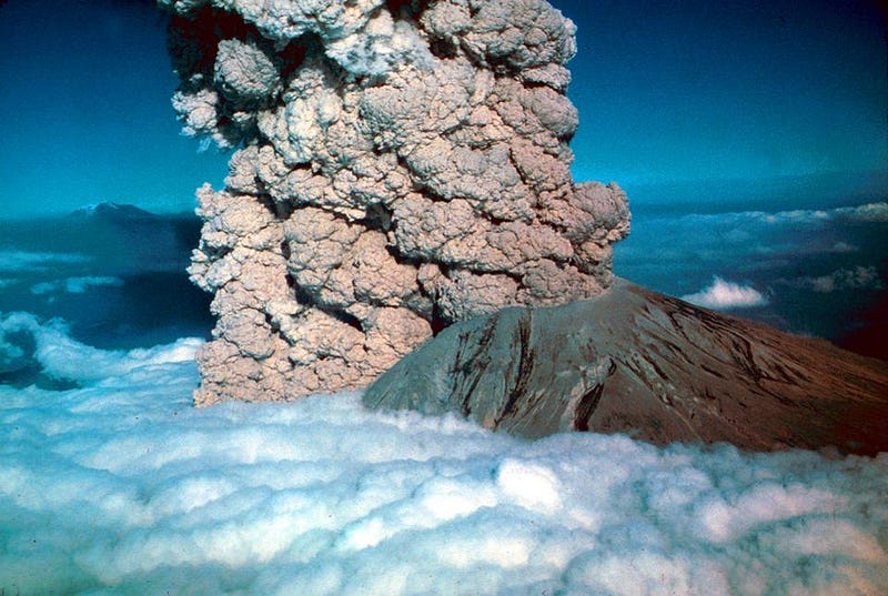
Ethan Siegel (ES): When people think of volcanic eruptions, they envision an explosive catastrophe, similar to what happened at Mount St. Helens in 1980. How is the situation in Hawaii, today, similar and different to that famous eruption?
Brian Shiro (BS): The volcanoes we have in Hawaii are shield volcanoes. The type of lava erupted here is low in silica content, which means it tends to be runny. It just oozes out and builds these low-lying, rounded volcanoes. The magma is also very low in water content, which means that we rarely have explosive eruptions.
When people think of Mount St. Helens, they of course remember the extremely violent explosion that happened there in 1980, and that’s due to the type of volcano it is. As a stratovolcano, it contains a great deal of water, and when water gets heated up by magma, it releases a lot of steam. Steam builds pressure, and mixes with other magmatic gases, leading to an explosive situation.
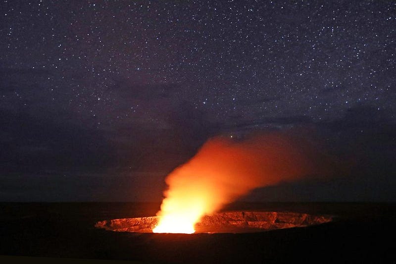
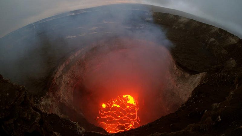
In Hawaii, we also have gases that erupt, and we’re currently experiencing a series of gas-driven explosions at the Kīlauea summit. These are also part of the portfolio of eruptions that happen during Kīlauea’s lifecycle. The most recent such eruption was in 1924, so it is not in the living memory of people here today.
ES: So even though this volcano is literally in the middle of the ocean, it doesn’t have a whole lot of water inside of the volcano itself. Why is that?
BS: Hawaiʻi sits on what’s known as a hot spot mantle plume. The magma source that drives Hawaiian volcanism comes from very deep within the Earth’s mantle. Down there, at such depths, you do not have a lot of water. Water is located mostly at the surface of the Earth, in the shallow-most layers. The sources of the magma for Hawaii are much deeper.
ES: What are the big dangers people should be worrying about, today, when it comes to the Kīlauea eruption?
BS: One thing to keep in mind for the Kīlauea eruption of 2018 is that it’s only affecting a small part of one island of the Hawaiian island chain. For most people who live here, and most visitors who come here, you can go about your business. But if you are close by or downwind of one of the affected areas, which includes Kīlauea’s summit area and lower east rift zone, down near Leilani estates, people need to be aware that there are hazards.
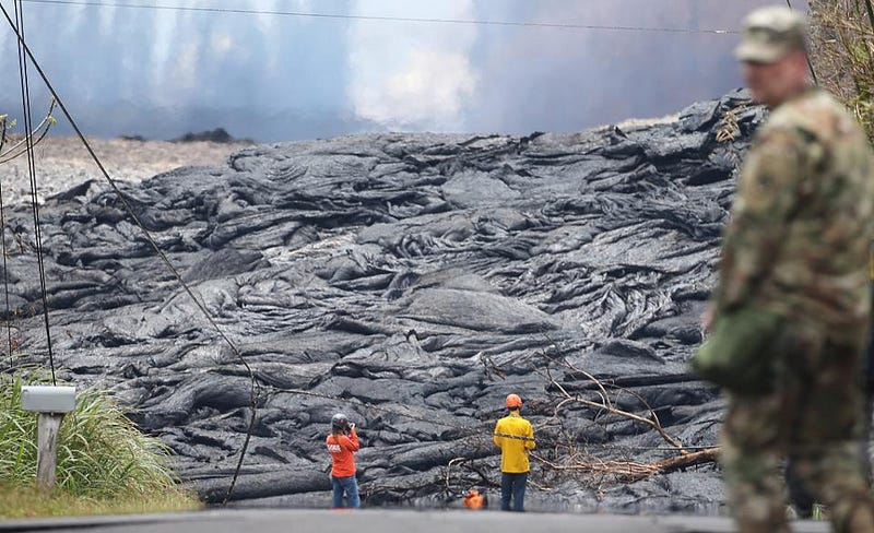
You should stay clear of the lava flows themselves. Admire them from a distance, or from photos and videos instead. These cause trees and power lines to fall, creating a hazard with electricity. When they do burn homes, the fires can release toxic gases or cause propane explosions. Always be aware of your escape routes when you’re near lava flows; don’t get trapped.
The most widespread hazards come from volcanic gases, sulphur dioxide being the principal one. People should know that too much exposure to sulphur dioxide is harmful to your health, and you should wear a respirator if you’re near it. If you’re near the ocean entry, where the lava is currently going into the ocean, it creates a material called laze, which is a mixture of hydrochloric acid gas, steam, and the quickly-quenched lava, which creates small glass particles that you definitely do not want to inhale.
And the final hazard, if you’re near or downwind of Kīlauea’s summit, is ash. This ashfall can be a nuisance, and it can also be a safety hazard. For example, if it gets wet, it can make the roads slippery, weigh down gutters, and contaminate catchment water supplies. Be sure to wear respirators around ash, because you don’t want that in your lungs, either.
ES: Minor property damage seems pretty mild compared to some of what’s being reported. The media is using some pretty fearsome words to discuss the dangers, such as “lava bombs,” when they talk about some of the problems that might affect people near the eruption. What are they, and are they as dangerous as people may be led to believe?
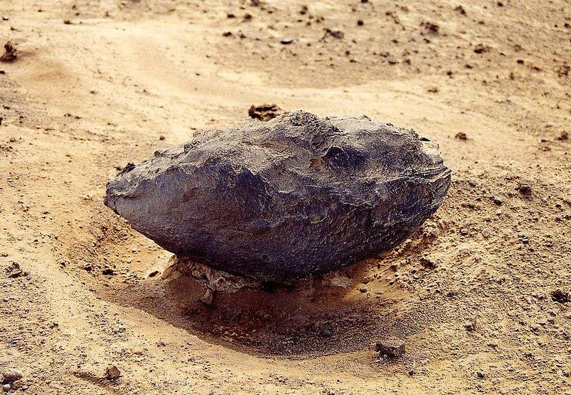
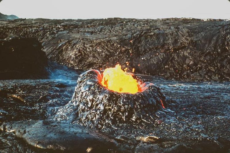
BS: A lava bomb is a real thing! It’s an airborne piece of molten material, lava, that comes out of a volcano in the air, and solidifies before it hits the ground. Because it solidifies in the air, it takes on kind of a teardrop, aerodynamic shape, and these can be quite large in some cases, depending on the energy of the eruption.
But lava bombs are not a particularly widespread hazard. They are constricted to the areas around the eruptive vents where the lava is fountaining, or in the case of the summit, gases are exploding. It’s one of the reasons why the National Park is closed, because they don’t want to take any chances of impacting anybody.
Historically speaking, when we’ve had explosive summit eruptions at Kīlauea before, most recently in 1924, there were a number of lava bombs that were ejected. Some were quite large, reaching distances of up to a kilometer, while pea-to-marble-sized ones can go up to about 6 kilometers, but all within Halemaʻumaʻu crater, which is the summit crater of the caldera.
ES: Geologically, this has been a particularly energetic eruption. In the terms a geologist thinks of, how disastrous has this eruption been, thus far, compared to the previous events that have been documented in Hawaii’s history?
BS: That’s a good question. This is certainly one of the most dynamic, complex eruptions we’ve had in anyone’s lifetime. The most recent analog to this eruption was in 1924; when a lava lake at the summit drained, you started to have a lot of explosive activity there, and also activity occurring down on the lower east rift. There were eruptions in 1955 and 1960 in the lower east rift that has a lot of similarities to what we’re seeing today, as well, with multiple fissures opening up along a line in that area of the island.
ES: In the legendary eruption of 1790, over 400 people were killed: the most disastrous volcanic event in the history of what is now the United States. No one has yet been killed in this year’s eruption at Kīlauea. What are we doing right to protect the citizens and residents of Hawaii?
BS: The eruption of 1790 is the largest eruption recorded in history for Hawaii. Not to say it’s the largest that’s ever happened, but it’s the largest since people were here keeping records. It did famously wipe out an army, which was marching to go conquer another army, and that changed the political landscape of Hawaii at the time. The 1790 eruption was similar to 1924 and to 2018 in some ways, but it was much more energetic. For example, there was much more subsidence — that means down-dropping — in the caldera, leading to higher levels of expulsive activity.
Of course, at that time, they didn’t have the benefit of scientific monitoring like we have now. Today, we have the most well-studied volcano on the planet. The Hawaiian Volcano Observatory has been here since 1912, studying Kīlauea, as well as Mauna Loa and other Hawaiian volcanoes. We have a whole host of instruments and about 300 stations around the island, where we monitor many different parameters related to the volcano. In 1790, they didn’t have that. They just felt the earthquakes, saw the ash, and experienced the eruption as it happened. They didn’t benefit from any of the precursory type of information that we can measure today.
ES: A lot of people are curious about realistic, worst-case scenarios for residents of Hawaii, particularly on the Big Island. You mentioned using a respirator to breathe, avoiding the sulfur dioxide and the resultant Vog that it creates, and I’m curious about what a reasonable person would do to protect themselves in this situation?
BS: People who have lived on the southern part of the Island of Hawaii for some time, or visited the island, know that we live on an active volcano. It’s just part of everyday life. Since the current phase of the summit eruption began in 2008, with the opening of the Halemaʻumaʻu vent and creation of a lava lake there, it changed the landscape in terms of the gas emissions from the summit. Output of Vog, which is volcanic smog, has increased from the summit during the past decade as a result, and it’s become part of everyday life here. People watch the Vog forecast, which is based on the gas output of the volcano and the direction of the winds, to see what it’s going to be like each day. It’s something that can be managed, and a hazard that can be mitigated.
The lower east rift zone eruption that began on May 3 has increased Vog emissions on that part of the island, particularly if you’re in the Leilani estates area, near the active eruption. Also, the draining of the summit’s lava lake and resulting explosive activity has created increased gas output from Halemaʻumaʻu crater and more Vog in downwind areas from the summit. Those are the two sites where the eruption is happening right now, and gas output is high. But what you do to mitigate Vog exposure is really not different now than it has been for a decade here.
ES: So does this mean that unless there’s a big change, a new explosive event, a potentially triggering earthquake, or some other new aspect to this disaster, people should go about their daily lives, taking the same precautions they’ve always been taking?
BS: Yes, people who live here or visit here just need to have good situational awareness. Watch the forecasts that come through the Hawaiian Volcano Observatory’s website and our partners’ websites to know what the situation is for each day. What is the Vog doing? Where is it being blown? That’s the number one hazard because it’s the most widespread hazard. The wind can blow it around to other places. A related aspect to watch is the ashfall hazard, which waxes and wanes depending on the explosions at the summit.
ES: Just for a little bit of education for people curious about a little more geology, you’ve used some terms that people might not be familiar with. What is the difference between a rift, a fissure, and a caldera?
BS: Rifts are basically long, linear areas where you have preset pathways where magma can erupt. The highest lava hazard areas are along those rift zones. A fissure is a more local feature. Fissures are simply cracks where lava comes out. Caldera refers to the big crater that is at the summit of a volcano. They are collapse features formed after large volumes of evacuated magma leaves the ground unsupported.
Over time, a shield volcano organizes itself into a summit, crater, complex, and rift zones. The directions of rift zones are set up by regional stresses. For example, Kīlauea is on the edge of Mauna Loa, a much bigger and older volcano, and that means the rift zones of Kīlauea can spread out parallel to that boundary with Mauna Loa to the east and southwest.
ES: As I understand it, Mauna Loa is possibly, top-to-bottom, the largest active volcano in the world. Is there any reasonable situation under which what’s occurring at the Kīlauea volcano could potentially trigger some sort of larger disaster from a neighboring volcano?
BS: We know that Kīlauea and Mauna Loa volcanoes, at some depth beneath the island, share a common magma supply. It has been observed over time that the two volcanoes do play off one another in some ways; as one will become more active the other will become less active and vice versa. Basically, they serve as pressure release valves for one another.
In 2015, Mauna Loa started showing increased signs of unrest. That means these precursory geophysical signals, like earthquakes and deformation, started cluing us in that there was a possible magma intrusion under Mauna Loa’s summit. As a result, we raised the alert level to an advisory. Interestingly, over the past several months, those signs have tapered off dramatically for Mauna Loa. During that time, Kīlauea’s summit pressurized, the east rift zone inflated, and this ultimately led to the eruption we have today. So now, at the current time, I think the chances of Mauna Loa erupting, in the aftermath of Kīlauea, are very slim.

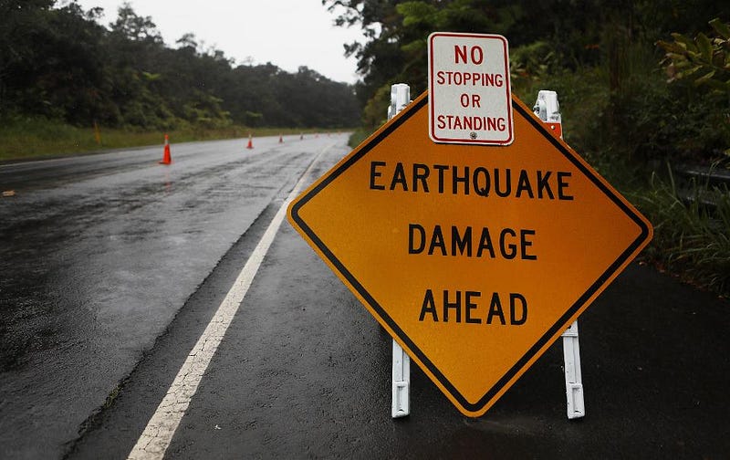
ES: Your expertise is in seismology. A few days prior to the May 3rd fissures, earthquakes and tremors began to shake the ground near Kīlauea. What lessons have we learned about the connection between earthquakes and volcanoes, and what does this teach us about predicting potentially disastrous volcanic eruptions?
BS: Unlike predicting earthquakes, which so far eludes seismologists, we can actually predict volcanic eruptions fairly well, given sufficient monitoring and understanding of the volcano. One of the major tools in our toolbelts for this is seismology. The idea is that as magma moves around underground, it breaks rock in the process. Breaking rock sends vibrations through the ground as earthquakes that we can measure. If we pay close attention to the pattern of the earthquakes in space and time, we can track the movement of magma beneath the surface. We look for earthquake epicenters marching laterally to indicate magma propagation, and if they start getting shallower towards the surface, that might indicate where an eruption could happen.
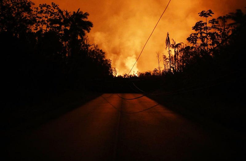
On April 30th, the site of the long-lived, 35-year eruption at Pu’u ‘Ō’ō cone, collapsed in on itself. That set things in motion towards this eruption that we have right now. All the magma that was there drained into an underground sheet of magma known as a dike. For four days, we tracked many hundreds of earthquakes propagating eastward down the rift, in advance of the magma, which pushed its way all the way to Leilani Estates, where it first erupted on May 3rd.
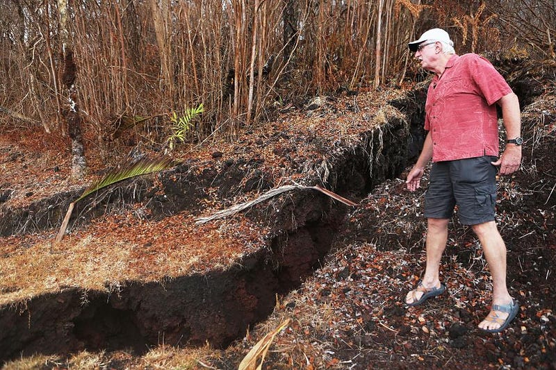
Meanwhile, ground crews looked for other telltale signs of impending eruptions. This includes the opening of ground cracks, which produce steam when magma heats water in them, and eventually produce lava at the surface. This is how we were able to pinpoint the likely spots where fissures will open and which residents need to evacuate first.
ES: When we see that earthquakes stop occurring, does that signal that the future volcanic activity is going to die down a bit?
BS: Not necessarily. For example, while we have seen a decrease in earthquake activity in the lower east rift zone this past week, we’ve not seen a reduction in the eruptive activity at all. Two things help explain that. One is that the path has already been opened. The work was done already to break that rock to open up those fissures at the surface, so there are few earthquakes. This also is observed with deformation, where we’re measuring how the shape of the Earth changes to accommodate magma movement. The past week has shown very little deformation in the lower east rift, suggesting that the space has already been made. Magma is flowing freely without displacing the surrounding rock very much.
The second factor involves chemistry. The first lavas that were erupted during this sequence were all of a chemical composition assumed to be left over from the 1955 eruption. That magma had been stored underground since 1955, and during that time had been aging, degassing and crystallizing. The result is that makes it stickier, more viscous, harder to move, and resistant to flow. For all those reasons, it took a lot of work to squeeze that magma out. We saw that reflected with seismic and deformation data.
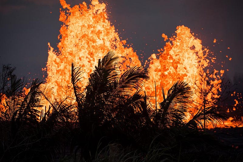
This past week, that all changed. Now the lavas have the chemical character of the Pu’u ‘Ō’ō lavas, which are much younger, runnier, less viscous, and richer in gas. Not only is the path already open, but the lava is also more fluid. There’s no need to make earthquakes. We’ve seen this shift at the surface with the development of high lava fountains, leading to perched lava ponds, and lava channels that have reached the ocean. This is all thanks to the arrival of younger lava into the system from about Fissure 18 onward.
ES: So it sounds like it generally takes decades for stresses to build up, and then a big “release” occurs, providing a new path for those stresses to release. Does this mean we’re likely to be entering a quasi-stable period where what we see now is indicative of things to come?
BS: Previous lower east rift eruptions like this have lasted on the order of a few months, so, that’s the timeframe we’re guessing for this eruption. But we really don’t know what nature will have in store for us. One scenario is that we’ll go a few months, like in 1955 or in 1960, and that will be it. But another scenario is that this may signal the formation of a new long-lived shield-building phase, which is what Pu’u ‘Ō’ō was. The bottom line is we don’t know: it could be weeks, months, or years.
ES: The biggest fear that a lot of people have is that pesky use of the word “unpredictable” when it comes to Kīlauea. What would you say actually is the unpredictable thing or things that people should be worrying about?
BS: The good news is that both eruption areas, at the summit and the lower east rift, are localized places that people can easily avoid. It’s certainly not good for people who have made their homes in the immediate areas. This is very disruptive to them, of course. For anyone else, you can stay out of harm’s way, easily.
For predicting how that activity will change, we have to keep our fingers on the pulse of all of our instruments. We’ve touched on seismology, deformation, and gas monitoring so far. Those are three of the big tools we use.
The fourth is geologic observation. We have field crews on the ground and in the air every day, working shifts around the clock, measuring cracks, talking to residents, mapping lava flows, and observing how it’s all changing and advancing.
It takes all four of these disciplines, put together, to have a comprehensive view of the situation, and best gauge what might come next. At our science meetings, we get together, we all talk among the different disciplines, and we put the different pieces of the puzzle to figure out what we should do next, and what our recommendations should be. I think it’s a mitigable hazard.
ES: I’d like to switch gears to something lighter for a little bit. People have seen some weird structures as a result of this latest set of activity that got a little bit of coverage: “lava eggs.” These looked like glowing, miniature cinder cones with cracks all throughout them. How are they formed, and what are they all about?
BS: I actually don’t know. It’s possible they are something called hornitos, which are a little bit like lava chimneys. While they’re forming, they can be glowing until everything has cooled off. I’m thinking that these so-called lava eggs are actually hornitos, which is a well-known type of structure formed from eruptions like this. There certainly are other examples in Hawaii of hornitos that have formed. Some can be larger than a person.
ES: Last thoughts. If you had one final message to send out to the general public about Kīlauea, Hawaii, health, safety, and earthquakes and volcanoes in general, what would it be?
BS: I think Hawaii is a unique place on this planet. These volcanoes are well-studied and have a long, historic record. People have lived here over 1,600 years and learned how to live in harmony with active volcanoes, understanding, respecting, and in many cases, revering these wonders of nature. I think this combination of modern scientific monitoring and Hawaiian cultural appreciation for the volcanoes makes for a very supportive atmosphere where residents and scientists alike can come together in mutual admiration for the power of volcanoes. They are creating new land, for example, which is a beautiful thing. The hazard can be disastrous, of course, but people need to realize that we can’t stop it. All we can do is get out of the way.
ES: Brian, you make us so appreciative for all the efforts that people like you devote your life to. You’re literally gathering information that’s saving people’s lives, and teaching us about how the world works at the same time. Thank you so much for your time and your thoughts.
BS: Thank you, I appreciate it.
* — This interview has been edited for brevity in places.
Ethan Siegel is the author of Beyond the Galaxy and Treknology. You can pre-order his third book, currently in development: the Encyclopaedia Cosmologica.