Why are these borders so weird?
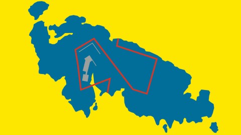
Image reproduced by kind permission of HarperCollins
- Borders have a simple job: separate different areas from each other.
- But they can get complicated fast, as shown by a new book.
- Here are a few of the bizarre borders it focuses on.

The island of Märket has a strange border dividing it into a Swedish and a Finnish half. Why? Because of a misplaced Finnish lighthouse (shown on the western half of the island).Image reproduced by kind permission of HarperCollins
What separates us humans from other animals? The use of tools or language? The invention of God or music? The ability to blush? (According to Mark Twain, we’re the only animal that can – or needs to). The jury is still out. For a swifter verdict, ask what separates humans from each other. Quite literally, it’s borders.
Those borders can be the subtle separators of culture and class; the more tangible distinctions of race and gender; or the physical demarcations between this country and that. The job description for political borders is simple and straightforward enough: draw a line between areas with different rules (and rulers). But, as shown in a new book, those lines are not always straight and simple.
For reasons geographical, dynastic, military or otherwise, things on the ground can get quite complex quite fast. In “The Atlas of Unusual Borders,” map enthusiast Zoran Nikolic zooms in on some of the world’s most egregious examples of border weirdness. Here are a few samples from the recently published book.

Ideally, Cyprus shouldn’t have any internal borders at all. Then, history happened.Image reproduced by kind permission of HarperCollins
Cyprus is a good example of the distance between theory and practice. As an island nation, it shouldn’t even have land borders. Yet the small Mediterranean country is riven with borders, establishing four different political entities.
The oldest Cypriot border only goes back to 1960, when the island gained its independence from Britain. The former colonial overlord retained two large military bases, covering a total of 3 percent of the island’s territory. Today, Akrotiri and Dhekelia – strategically close to the Middle East – remain under British control.
But while Akrotiri, near the city of Limassol, is a single, contiguous lump of land, Dhekelia, the other ‘Sovereign Base Area’, seems designed to make life difficult for the Cypriots: a tentacle pokes through in the direction of the island’s eastern shore, almost touching Varosia, a former jet set hotspot just south of Famagusta, now a dystopian no man’s land. The main body of Dhekelia is dotted with numerous exclaves of Cypriot sovereignty, containing two entire villages and one power station.
Dystopian no man’s land? That goes back to 1974, when Turkey invaded, to help Turkish Cypriots set up their own, internationally unrecognised state in the north of the island. The as yet unresolved nature of that conflict is symbolised by the Green Line, separating the official, Greek-majority south of the island from the Turkish Republic of Northern Cyprus – recognised only by Turkey itself. That Green Line is not actually a line, but a UN-administered buffer zone, wide enough to contain the island’s former international airport, for example.
The 1974 conflict has also stranded a Turkish-Cypriot coastal town south of the line. Erenköy (in Turkish; Kokkina in Greek), in the west, is a ghost port, a small Turkish garrison its only occupants. In the east, the Green Line intersects with the already complicated borders of Dhekelia, cutting off a large part of Greek Cyprus from its ‘mainland’. However, traffic with the rest of Greek Cyprus is possible via Dhekelia, ensuring a steady flow of tourists to Ayia Napa, the exclave’s main resort.

‘Four Corners Canada’: North America’s other quadripoint, where the Northwest Territory, Nunavut, Saskatchewan and Manitoba meet. Image reproduced by kind permission of HarperCollins
Quadripoints, where four political entities touch in a single point, are rare. The last international one was extinguished after World War I. There is a tangle of borders in southern Africa that comes close – but misses the mark by about 300 meters. At the sub-national level, the United States has its famous Four Corners. After a serious trek through the desert, tourists arrive at what must be one of the loneliest attractions in North America: the monument to the meeting point of Colorado, Utah, New Mexico and Arizona.
Well, that attraction has a potential competitor far north. On April 1 1999, when Canada created the territory of Nunavut, it also created a new quadripoint, where the new territory of Nunavut meets the now reduced Northwest Territories, plus the prairie provinces of Saskatchewan and Manitoba. ‘Four Corners Canada‘ already has its monument: the metal marker on the (former) Northwest-Saskatchewan-Manitoba tripoint.
However, pending an official land survey, some doubt remains as to whether the legal definition of Nunavut’s border actually aligns with reality. Furthermore, ‘Four Corners Canada’ is located 1,200 km (725 miles) north by northwest from Winnipeg, which makes it vastly more remote than ‘Four Corners USA’. So it’s doubtful whether North America’s newest quadripoint will ever become a tourist attraction.

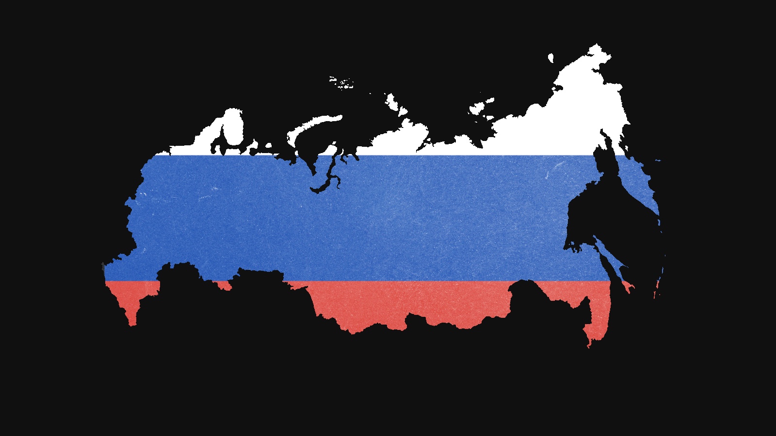
So small and insignificant is this Russian exclave that it is left off most maps. But don’t count on Russia abandoning it.Image reproduced by kind permission of HarperCollins
Russia’s most famous exclave is Kaliningrad, the northern half of what used to be East Prussia. After the disintegration of the USSR and the independence of the Baltic states, it got separated from Mother Russia – yet another burden for the fledgling post-communist state. Amid the confusion and economic collapse of the early 1990s, there was even some talk of just selling it back to Germany. No more. A resurgent Russia will no longer tolerate territorial shrinkage. The annexation of the Crimea was a symbol of the turning tide.
So don’t expect Russia to give up this little exclave either. Even though, unlike Kaliningrad, it has no strategic value. Sankovo-Medvezhye is a small fragment of Russia misplaced just across its border with Belarus – 35 km east of Gomel, 530 km southwest of Moscow. The two small villages making up the exclave were abandoned after Chernobyl. The population at present is zero.
Most Russians have never even heard of this particular exclave, and it’s so small that it’s left off most maps. The only people remotely interested in Sankovo-Medvezhye are looters, who by now have stripped both villages of almost anything of value; and poachers, who use the exclave as a sanctuary both from the Belarus authorities, who can’t go there; and the Russian ones, who don’t bother.

Bremen has a coastal exclave? Then Hamburg wants one too!Image reproduced by kind permission of HarperCollins
Germany is composed of 16 Bundesländer – federal states that typically are big enough to be a small European country on their own, like Bavaria or Brandenburg. Three, however, are Singapore-sized city-states: the capital Berlin, and the North Sea port cities of Hamburg and Bremen – the latter being smallest of all Länder.
Those two rival states are mirror images of each other: proud and ancient trading centers, landlocked in or between larger states, accessible to seagoing vessels via their respective rivers. Bremen has the Weser, Hamburg the Elbe. But zoom in further, as this map does, and they’re even more alike.
At the 1815 Vienna Congress, Bremen obtained direct access to the sea in the shape of an exclave called Bremerhaven – big enough to be visible on most maps of Germany. (Actually, Bremen consists of three separate bits of land: Fehmoor is separated from Bremerhaven by a narrow strip of Lower Saxony. But let’s not get distracted).
What’s not so visible, is that Hamburg too has its own sea enclave. In fact, it has three: islands so small they usually don’t appear on any map. Thinking it would need a coastal toehold to develop a deep-draft port, Hamburg acquired Neuwerk (current population: 40) and its uninhabited sister island of Scharhörn after the Second World War.
Those deep-draft plans were eventually shelved, due to cost and environmental protests. A third island, Nigehörn, was created artificially to protect the bird sanctuary on Scharhörn. The three islands are still part of Hamburg, 120 km (75 miles) further up the Elbe, but they are now the anchors of a national park rather than a busy port.

In a region fought over so bitterly, Siga Island presents a remarkable exception: it is claimed by neither Croatia nor Serbia.Image reproduced by kind permission of HarperCollins
Never set a border in a river. The river will shift, and then you’re stuck with a mess made by two lines meandering all over each other. For some prime examples, check out the U.S. states who trusted the Mississippi to provide a neat and easy demarcation between them.
It gets worse when international borders are involved, as is the case between Croatia and Serbia. Of course, that border wasn’t international until Yugoslavia bloodily tore itself apart in the 1990s. Much of that border is formed by the Danube. And both countries have different opinions of how that river should be used to demarcate the border.
Right down the middle, Serbia says. Following old cadastral borders, Croatia maintains. Those cadastral borders follow a previous course of the river, which is why Croatia claims 10,000 hectares on the ‘Serbian’ side of the river. It also explains why Croatia doesn’t claim the 2,000-hectare Siga Island on ‘its’ side of the Danube – an area not claimed by Serbia either.
And there you have it: terra nullius. That’s legalese for No Man’s Land. However, like nature, geopolitics abhors a vacuum. Rather than wait or both countries to come to a compromise, various parties have sought to lay claim to the grey zone between them, and proclaimed it to be the Free Republic of Liberland, or the Kingdom of Enclava.
How will this end? While our hearts are with the micro-nationalists trying to do something new here, attempts at secession have generally not gone down well in this part of the world. Get ready to migrate your dreams to cyberspace, Liberlanders. (OK, check!)

During the Second World War, Hotel Arbez could simultaneously host both German solders (on the French side) and members of the French Resistance (on the Swiss side).Image reproduced by kind permission of HarperCollins
About 30 km (20 miles) north of Geneva, La Cure is a small village slap bang on the Franco-Swiss border. Quite literally so: half the village is French, the other half Swiss. The same goes for a bunch of buildings in town: the international border runs right through it.
One of those is the Hotel Arbez, and while that curiosity might have been a selling point for some of its earlier guests – the border passes through the double bed in the honeymoon suite, for example – during the Second World War, it became a major geopolitical fault line. While France was occupied by the Germans, Switzerland stayed neutral, independent and unoccupied.
It is said that during the war, on several occasions the French side of the hotel hosted German soldiers and officers, dining on the fine fare of the hotel’s kitchen; while members of the French Resistance stayed in rooms on the Swiss side. Naturally, if the Germans had caught the Resistance fighters on the ‘French’ side of the hotel, it would have ended in an arrest, or worse: a BBC comedy. But as long as they stayed on the Swiss side, they were untouchable – a very practical benefit of Switzerland’s famed neutrality.

Athos is a monastic republic, with some peculiar rules. Only men are allowed – exceptions are made for female cats and chickens. Image reproduced by kind permission of HarperCollins
Greece is not one country, but two. The more familiar one, simply called ‘Greece’, is a medium-sized modern European democracy with its capital in Athens. The other is a religion-based microstate on the easternmost of the three peninsulas of Chalkidiki – the only country in the world inhabited only by men. Its name? Mount Athos.
Named after its highest peak, Athos is sometimes also simply called ‘Holy Mountain’, because of the 20 monasteries and 2,000 monks on its territory. The monks have been here since the 8th century and have survived centuries of war and occupation (not the exact same monks, obviously). The Greek constitution recognises the Monastic State as a self-governing territory of the Greek state. The governor it sends to Athos is merely an observer.
For Athos is run by a religious council, made up of one representative per monastery. It has an executive body of four members (the ‘Holy Administration’), headed by a CEO (the ‘protos’). The monasteries attract monks from all over the orthodox world; residence at Athos gets them automatic Greek citizenship. In order not to disturb the contemplative life of the monks, no females are allowed on Athos. This includes female animals, with two exceptions: hens (to lay eggs) and cats (to catch mice; although one suspects the mice are co-eds too).

Tasmania is Australia’s only island state, yet it does share a land border with the rest of the country.Image reproduced by kind permission of HarperCollins
A small island beyond the island-continent’s south-eastern shore, Tasmania is Australia’s afterthought; Down Under’s own Down Under. It is the only state of Australia that is also an island. And yet Tasmania manages to share a land border with Victoria, the southernmost state on the Australian mainland.
It does so entirely by accident. When Tasmania’s sea border with Victoria was drawn at a latitude of 39°12′ South, it was thought the line crossed open water only. Upon closer inspection, however, the line did cross a tiny island, which an earlier survey had misplaced somewhat.
Too small and barren to be of any other interest, the rock, originally called North East Islet, was rechristened Boundary Islet, and its sole raison d’être now is to be a geopolitical footnote: the only land border of the island state of Tasmania, and the shortest of all land borders between Australian states: all of 85 m (93 yards).

St Pierre and Miquelon is the last surviving fragment of what was once the vast North American dominion of ‘New France’.Image reproduced by kind permission of HarperCollins
Until the mid-18th century, it was the French who were winning North America. They controlled New Orleans in the south, Acadia in the north, and a vast, unbroken stretch of territory in between. Then the Brits kicked them out of Canada, courtesy of the French and Indian War (1754-63), and the Americans bought the remainder off Napoleon in the Louisiana Purchase (1803).
But did the French give up all their possessions in North America? No! Like Asterix’s Gallic village that bravely holds out against the Roman invasion, there is one part of the formerly vast dominion of ‘New France’ that remains French to this day – St Pierre and Miquelon, two small islands in the North-West Atlantic, 25 km (15 miles) off the coast of Newfoundland (and 3,800 km – 2,350 miles – west of the Metropolitan France).
If it isn’t weird enough to find a slice of France stuck on Canada’s eastern seaboard, a look at the territory’s Exclusive Economic Zone raises eyebrows even further. The EEZ is the part of the sea over which a state has special rights (without having total sovereignty). The size and shape of St Pierre and Miquelon’s EEZ was long an object of dispute between Canada and France. In 1992, an international panel granted the islands the EEZ you see on this map. Extremely elongated, the 200 km (125 miles) long, 10 km (6 miles) wide zone has been compared to a key, a mushroom and (perhaps inevitably) a French baguette.
The reason given for the shape is that it would provide a corridor for French ships to have unhindered access to St Pierre and Miquelon from international waters. However, Canada later exercised its right to extend its own EEZ, stranding the baguette within Canadian waters. Game over, you might think; but only if you’re not French.
Zoran Nikolic: The Atlas of Unusual Borders, published by HarperCollins.
Images reproduced with kind permission.
Strange Maps #1033
Got a strange map? Let me know at strangemaps@gmail.com.
