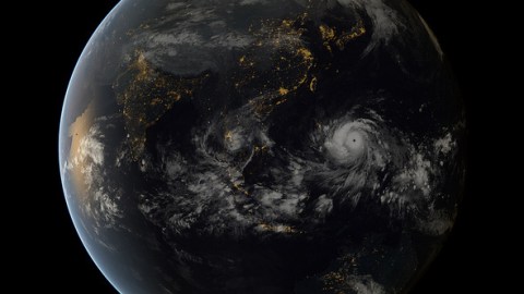
Typhoon Haiyan as Seen from Space

It’s difficult to wrap your head around the scale of destruction that was caused by Super-Typhoon Haiyan, the storm that may have killed as many as 10,000 people in the Philippines.
Satellite images released by NASA and other agencies provide some perspective. The image above is a photo from Japan Meteorological Agency and EUMETSAT.
The video below is an animation of NASA satellite data that shows the progression of the typhoon.
Watch here:
Credit: University of Wisconsin, CIMISS
This next video, created from satellite data on Nov. 8, shows Haiyan had a well-defined eye surrounded by a symmetric area of moderate rain (green ring with a blue center) with several rainbands wrapping in from the south (green arcs) while crossing the island of Leyte in the central Philippines.
Watch here:
Credit: NASA/SSAI, Hal Pierce


