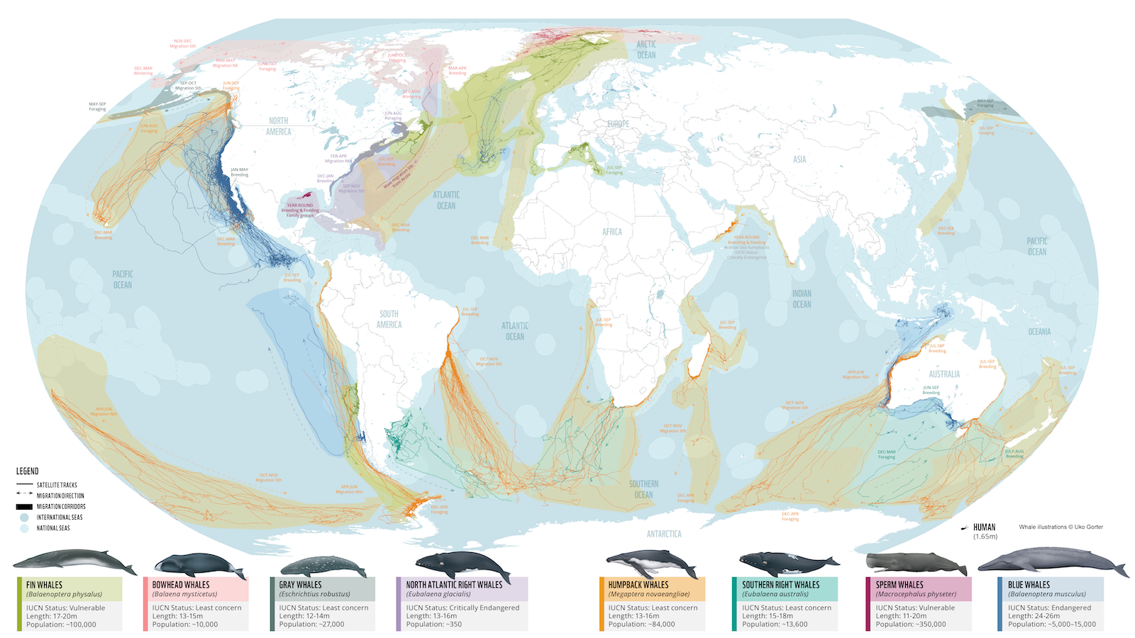
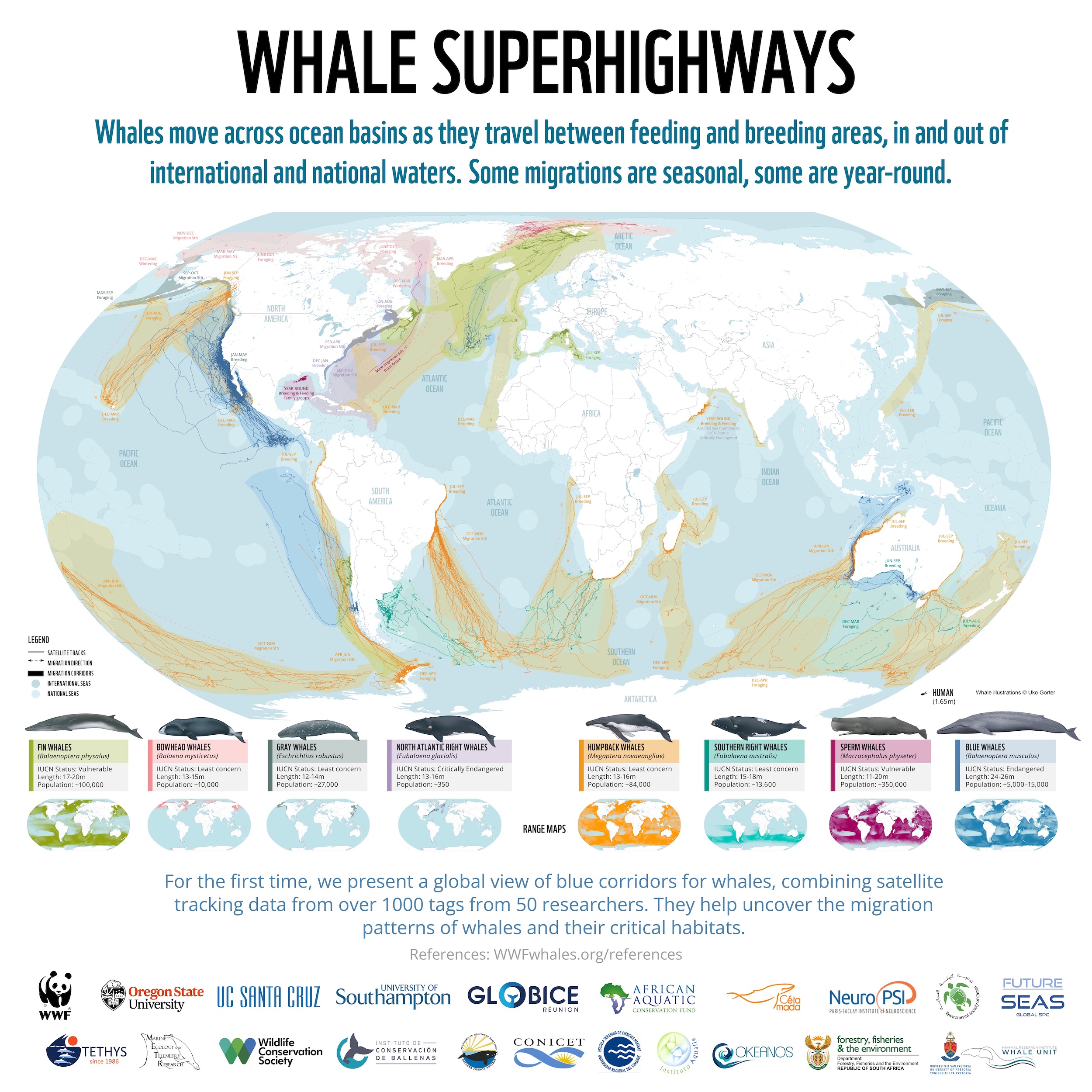
Map of whale migration “superhighways” might help save them from extinction
- About half of the world’s great whale species are vulnerable or threatened.
- This map is the first to visualize the migration routes of most of those species.
- It could become a tool to ensure that these whales not only survive but thrive.
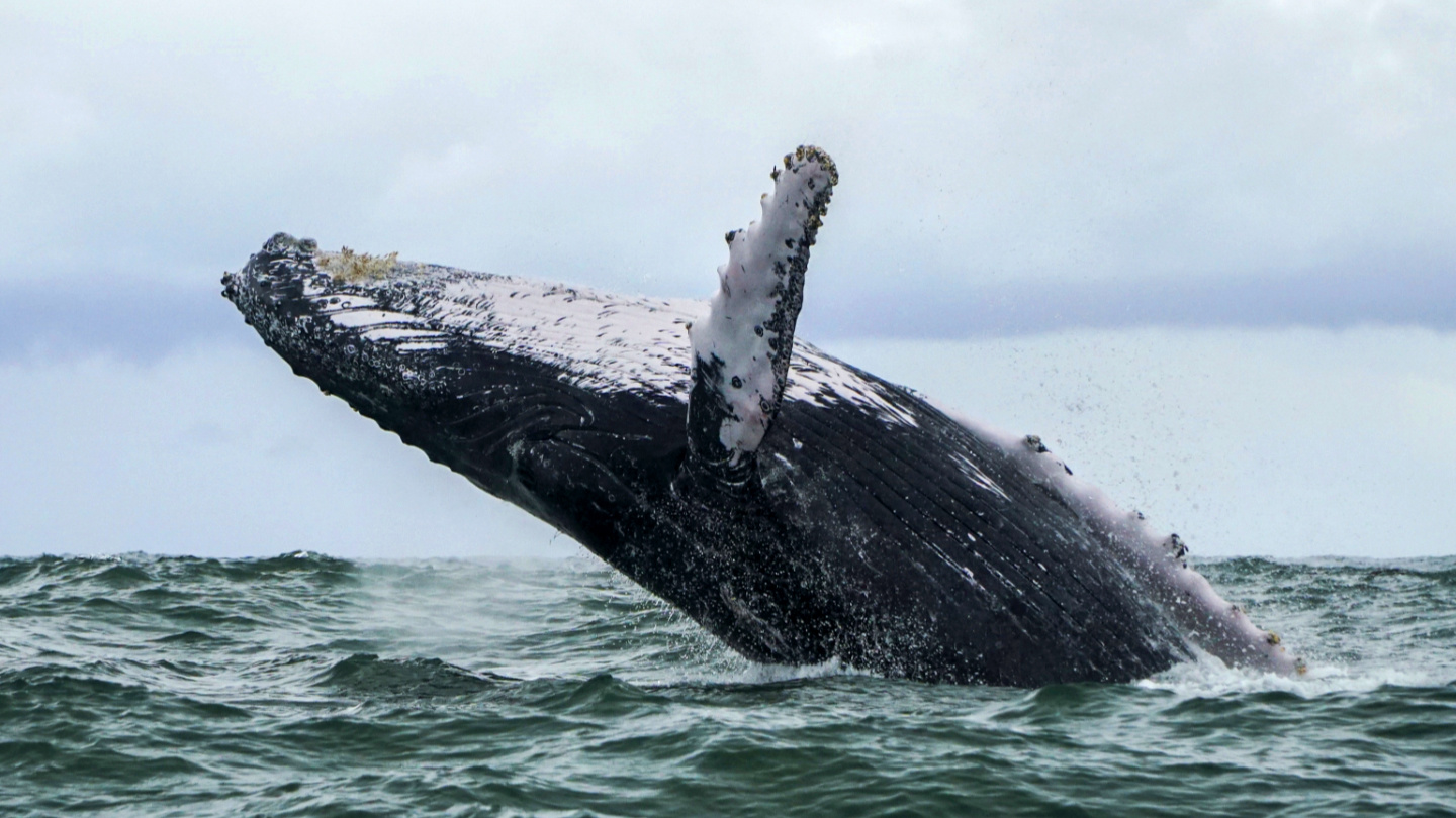
If you are a Viking bard, “whale-road” is what you could call the sea. It turns out there is some truth to that poetic turn of phrase. As this map shows, the world’s various whale populations follow very specific routes on their annual migrations — though by the scale of them, they are not so much whale roads as whale superhighways.
Where whales and humans intersect
Released this February by the World Wildlife Fund, the map of whale superhighways (also called “blue corridors”) was compiled by tracking 845 migratory whales with satellites over 30 years around the world’s oceans. The map provides the first global overview of whale migrations, and thus the first clear picture of whale superhighways around the world.
It shows where these giants of the seas feed, where mate, and give birth to and nurse their young. It also points out where those whale-roads intersect with human activity, often posing grave dangers to their ancient ways. Those dangers can be deadly for individual whales and risk being fatal for entire species.
That is why, even after decades of protection against commercial whaling, six of the 13 great whale species are now classified as vulnerable or endangered by the International Union for Conservation of Nature (IUCN). Worst off is the North Atlantic right whale, which is down to fewer than 340 individuals, its lowest point in 20 years.
Deadly entanglements
The deadliest human-made threat? Fishing nets. Each year, about 300,000 cetaceans (whales, dolphins, and porpoises) get caught up in them and die. According to one study, about 86% of right whales will get entangled in fishing gear at least once in their life.
And in the past five years, 34 North Atlantic right whales died from entanglement or the other frequent whale-killer: ship strike. Add to that plastic pollution, habitat loss, and climate change, and it is clear that whales need more than being left alone to survive.
The main point of visualising these blue corridors — partly coastal, but mainly out in the open seas — is to show the limited use of protecting whales only where they congregate seasonally, if they face deadly dangers along the rest of their migration routes. They need full protection along the full length of their superhighways.
The map is part of a larger study called “Protecting Blue Corridors,” which calls for whale conservation through international cooperation, which is particularly urgent as the United Nations is set to finalize negotiations on a new High Seas Treaty this year. Among other things, WWF advocates for a network of Marine Protected Areas, safer fishing gear, and software that would help ships avoid whale-strikes.
This map could become an essential tool in helping whales survive and thrive. And that is not just good for the whales themselves. There is growing evidence that whales help maintain the health of the oceans and regulate global climate. In terms of carbon capture, one whale equals thousands of trees: each great whale sequesters 33 tons of CO2 on average, taking that carbon out of the atmosphere for centuries. A tree, meanwhile, absorbs only up to 48 pounds of CO2 a year.
Strange Maps #1136
Got a strange map? Let me know at strangemaps@gmail.com
Follow Strange Maps on Twitter and Facebook